Kordasht
Kordasht Village, which is situated in the Jolfa County of East Azarbaijan Province has a small population (420 according to the 2006 census) but has been mentioned in the books of history for being the headquarters of a military command at some point in the history of the country.
Geography and History of Kordasht Village
Kordasht is located in the northernmost part of the Arsbaran region and on the southern bank of the Aras River. This region, which is also known as “Qaradagh”, is a vast mountainous region in the north of East Azarbaijan province, where the cities of Ahar, Kalibar, Varzeghan, Khoda Afrin, Hurand, and parts of Haris and Jolfa are located. Being of its ecologically important feature, more than 72 thousand hectares of its land were recognized as nature reserves or biosphere reserves by UNESCO in the year 1976.
This village borders Armenia and one of the main bridges crossing the Aras River is located near it, and for this reason, it was chosen as the headquarters of Iran’s military command during the Iran-Russia wars. These wars lasted for a total of 25 years during the Qajar dynasty and in two periods (1804 to 1813 AD and 1826 to 1828 AD) and finally resulted in Iran’s defeat and the separation of large parts of the Iranian land in the north of the Aras River. Abbas Mirza, Iran’s viceroy at the time, was the commander of the Iranian army in these wars.
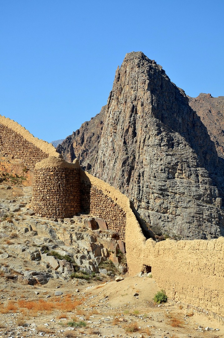
Being strategically located, fences and watchtowers had been built in the Kordasht village, which is presently located near the Nordooz border crossing. Kordasht is located in a very beautiful and fertile valley, and the Aras River flows through it. There are high rocky mountains with steep slopes in the north and south of Kordasht; creating a kind of natural fence for it. Perhaps it was because of this characteristic that the military commanders of Iran had chosen it as their headquarters.
Historical Bathhouse and Castle of Kordasht Village
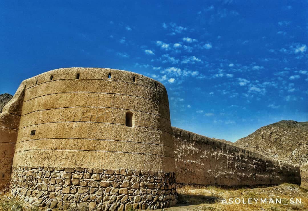
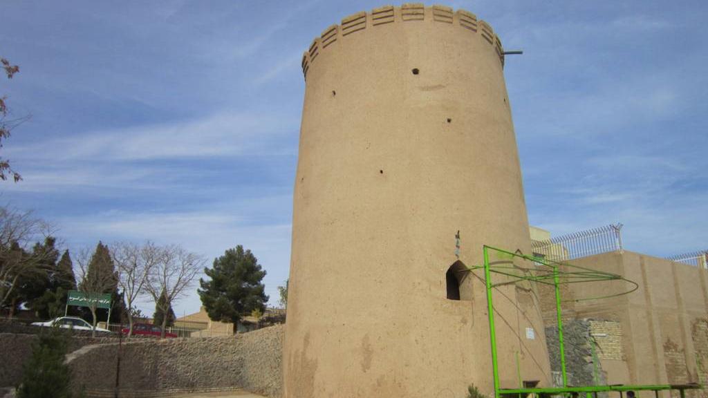
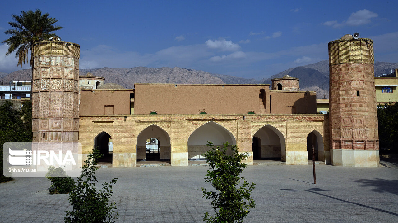
There are two historical sites in Kordasht Village, which are not unrelated to the military presence of the Iranian army in this region. One of these sites is the Abbasabad Castle built by Abbas Mirza’s order. Some experts believe that it was built on the ruins of a building that belonged to the early Islamic centuries. This castle is located on top of a rocky hill and at the northern entrance of Kordasht. Six watchtowers at distances of about six meters from each other can be seen in this castle. The upper parts of the walls are made of stone and brick. Kordasht Castle fell when the Russian army crossed the Aras River and entered Iran. Despite the fact that as per the Treaty of Turkmenchay, the lands south of the Aras River remained part of Iran’s territory, this castle was taken over by Russia. However, years later, this fort was vacated by Russian forces and lost its usage.
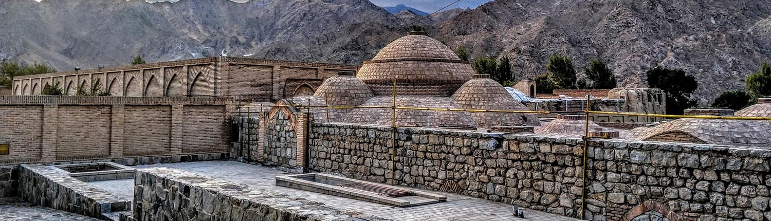
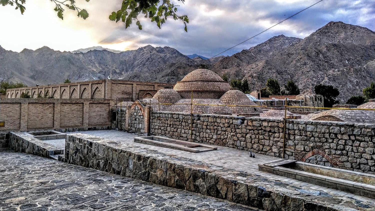
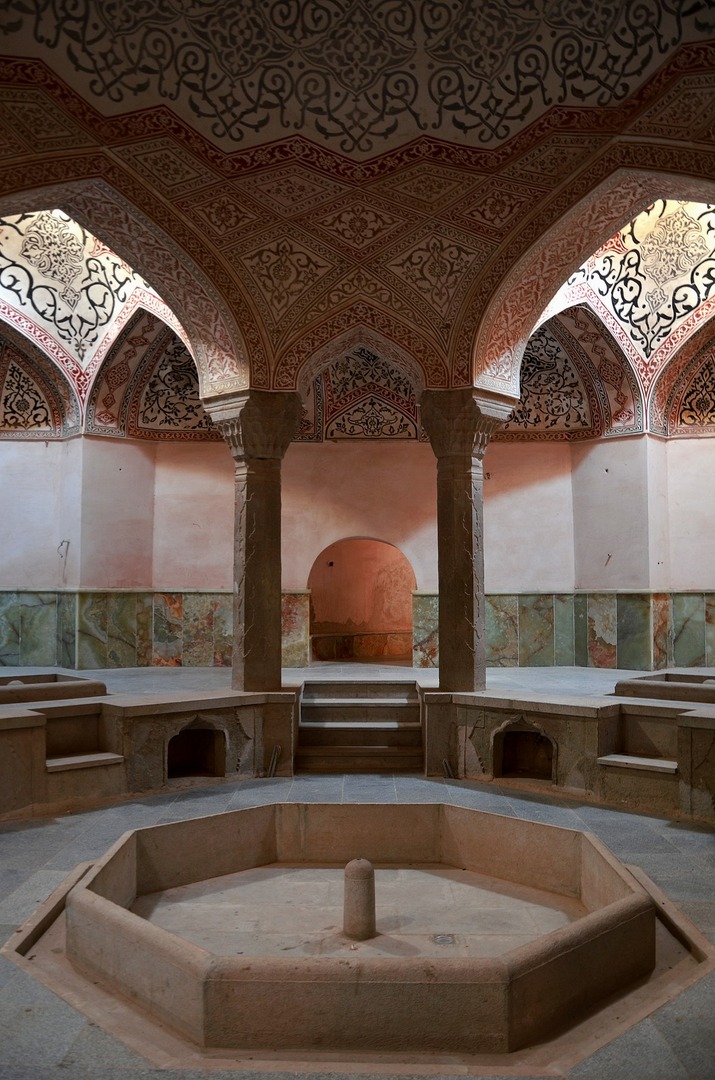
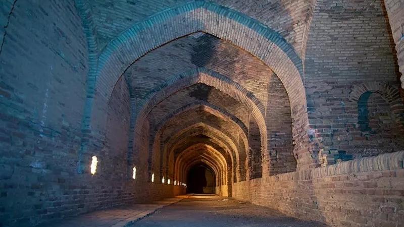
The bathhouse of Kordasht Village was built during the Safavid era and during the reign of Shah Abbas I (1587 to 1629 AD) and was restored during the Qajar era. Kordasht Bathhouse was inscribed on the list of Iran’s national heritage in 2003 AD and now it is used as a historical and recreational complex. The entrance to the bathhouse has a vestibule, which is connected to the dressing room after eight steps. Eight columns placed in an octagonal structure support the dome-shaped roof of the building. Eye-soothing and beautiful limestone carvings of the bathhouse have given it a unique effect.
Kordasht Village has become important in the history of Iran because of being chosen as the headquarters of Iran’s military command during the Iran-Russia wars.
| Name | Kordasht |
| Country | Iran |
| State | East Azerbaijan |
| City | Jolfa |
| Type | Historical |
| Registration | No registration |


 در تخت جمشید_crop_2.jpg)


Choose blindless
Red blindless Green blindless Blue blindless Red hard to see Green hard to see Blue hard to see Monochrome Special MonochromeFont size change:
Change word spacing:
Change line height:
Change mouse type: