Kharanaq Waterway Bridge: Iran’s Only Traditional Water-Transfer Bridge
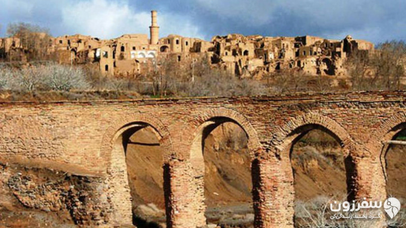
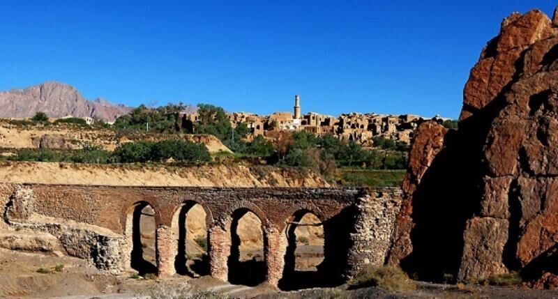
Kharanaq: A Unique Village in the Desert Province of Yazd
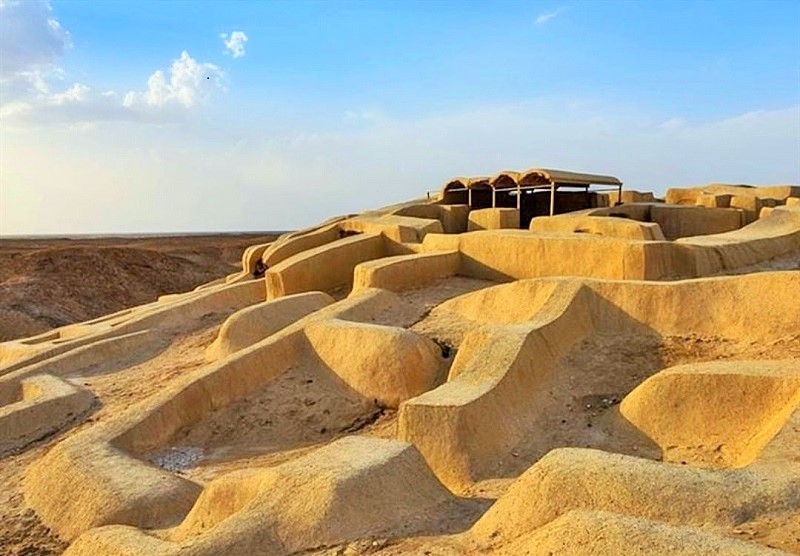
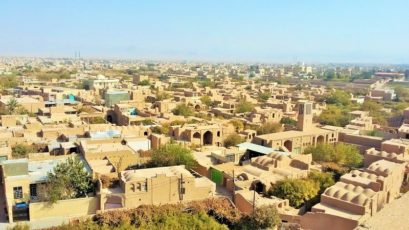
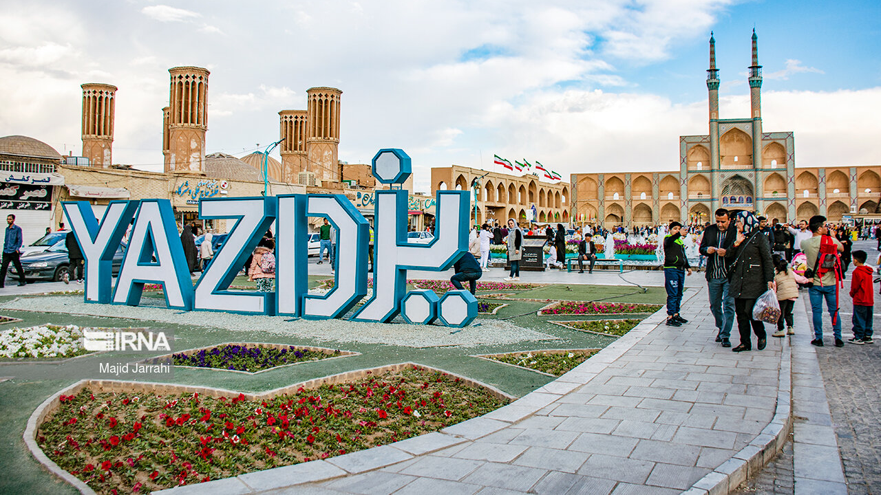
The province of Yazd, located in Iran’s central desert belt, lies within the dry and semi-arid zone of the Northern Hemisphere. Within a wide valley between the Shirkuh and Kharanaq mountain ranges, the historic village of Kharanaq is situated, about 60 km from the city of Ardakan. The region has a hot and dry climate. Ardakan county is strategically important, home to mineral resources such as the Chadormalu iron mine, Saghand uranium mine, and barite, zinc, and granite mines. Nearby, the Darre-ye Anjir Protected Area hosts wildlife including goats, rams, wild cats, lynxes, cheetahs, and houbara bustards, making Ardakan one of Yazd’s most distinctive counties. Kharanaq, whose name is derived from “Khurnaq” or “Khuranq” meaning “place of the sun’s birth” or “sunrise”, is rich in cultural heritage. The village boasts several historical structures: a castle, bathhouse, caravanserai, water reservoir (Ab Anbar), and mosque. One of its most unique attractions, unparalleled in Iran, is a dual-purpose water bridge—designed primarily to channel water while also allowing pedestrian passage.
History of Kharanaq Bridge
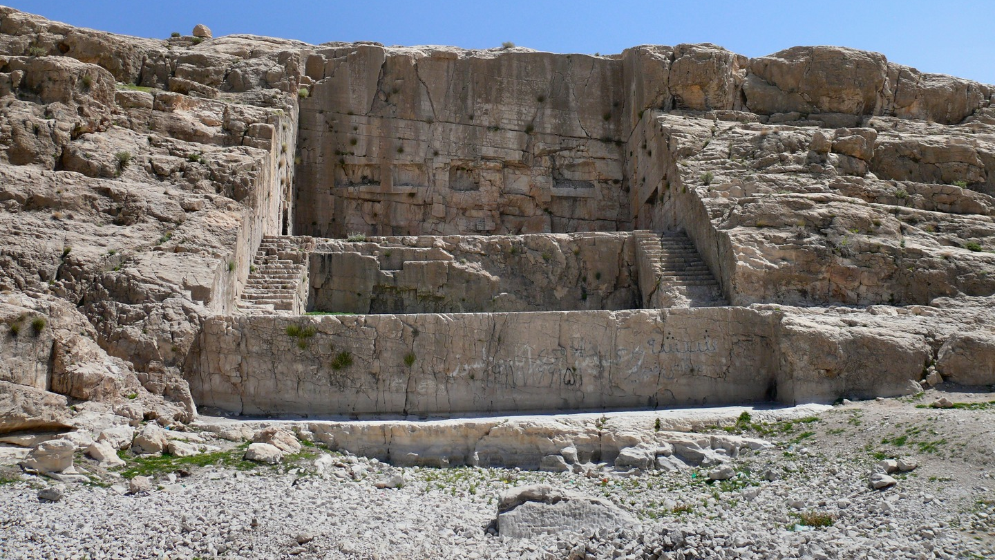
Apart from the qanats and their subsidiary channels, which are ancient water-transfer structures dating back thousands of years, the Kharanaq Bridge stands as one of the oldest water-transferring constructions in Yazd Province, featuring a unique and local engineering method. Experts believe the bridge’s foundations were laid during the Seljuk period (11th century CE), while the superstructure was constructed in the Qajar era (19th century CE). According to accounts from the village elders, the upper part of the bridge collapsed over a century ago due to flooding and was rebuilt during the Qajar period. During this reconstruction, the bridge was enhanced with proper engineering principles and a new feature called “Shotor-galu” was added, giving the bridge a more optimal and enduring design.
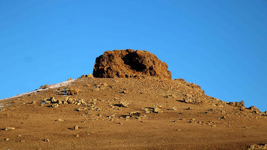
The residents of Kharanaq also refer to the bridge complex as “Ab-bareh Kal” or “Pol-e Estro”. In the local dialect: “Ab-bareh” means water channel or stream, “Kal” refers to a seasonal river over which the bridge is built. The term “Estro” was used by locals to name the lands on the far side of the river, and the bridge served as a path to move to Estro. A distinctive feature of the bridge is the “Shotor-galu”, a structure formed by natural erosion from water flow. Its design naturally clears sediment, allowing cleaner water to flow under the bridge.
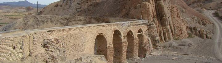
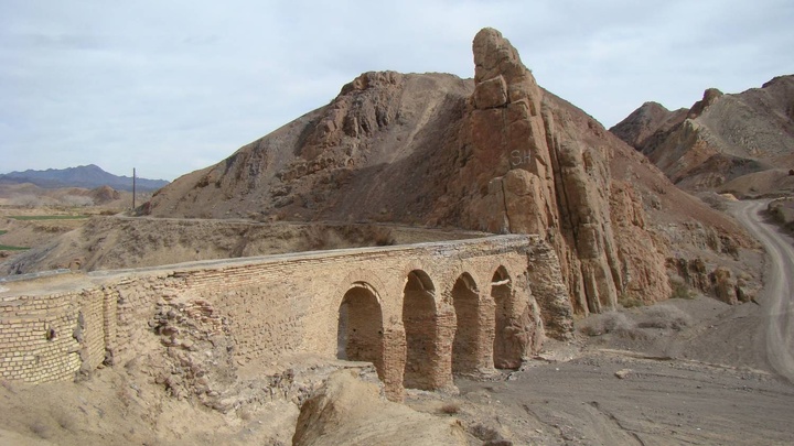
Architecture and Features of Kharanaq Bridge
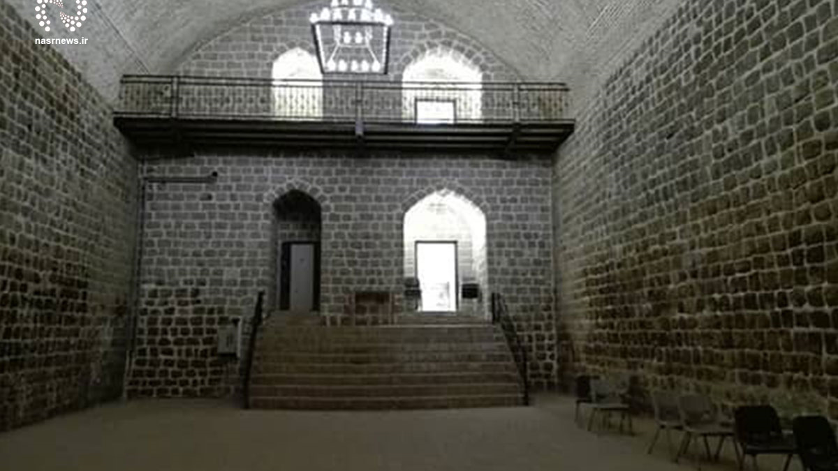
Kharanaq Bridge is a brick structure, and the use of bricks contributes significantly to its durability. Base bricks: Red in color, weathered over time, set on multiple layers of stone, and bonded with traditional mortar (sarooj). Dimensions: 25 × 25 × 5 cm. Upper bricks: Yellow in color, appear newer than the base. Dimensions: 20 × 20 × 5 cm. The bridge has four arched spans and three piers, with overall dimensions: Length: 40 meters, Width: 5.1 meters and Height: 5.7 meters. The bridge has a gentle slope of about 2%, which helps guide water flow. Even today, during rainfall, the bridge effectively channels water from one side to the other.
National Registration of Kharanaq Bridge
The Kharanaq bridge complex, including both the waterway bridge and the “Shotor-Galu” section, was officially registered as a national heritage site of Iran in 2014 (1393 in the Iranian calendar).
| Name | Kharanaq Waterway Bridge: Iran’s Only Traditional Water-Transfer Bridge |
| Country | Iran |
| State | Yazd |
| City | Ardakan |
| Type | Natural |
| Registration | National |


Choose blindless
Red blindless Green blindless Blue blindless Red hard to see Green hard to see Blue hard to see Monochrome Special MonochromeFont size change:
Change word spacing:
Change line height:
Change mouse type: