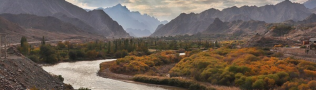
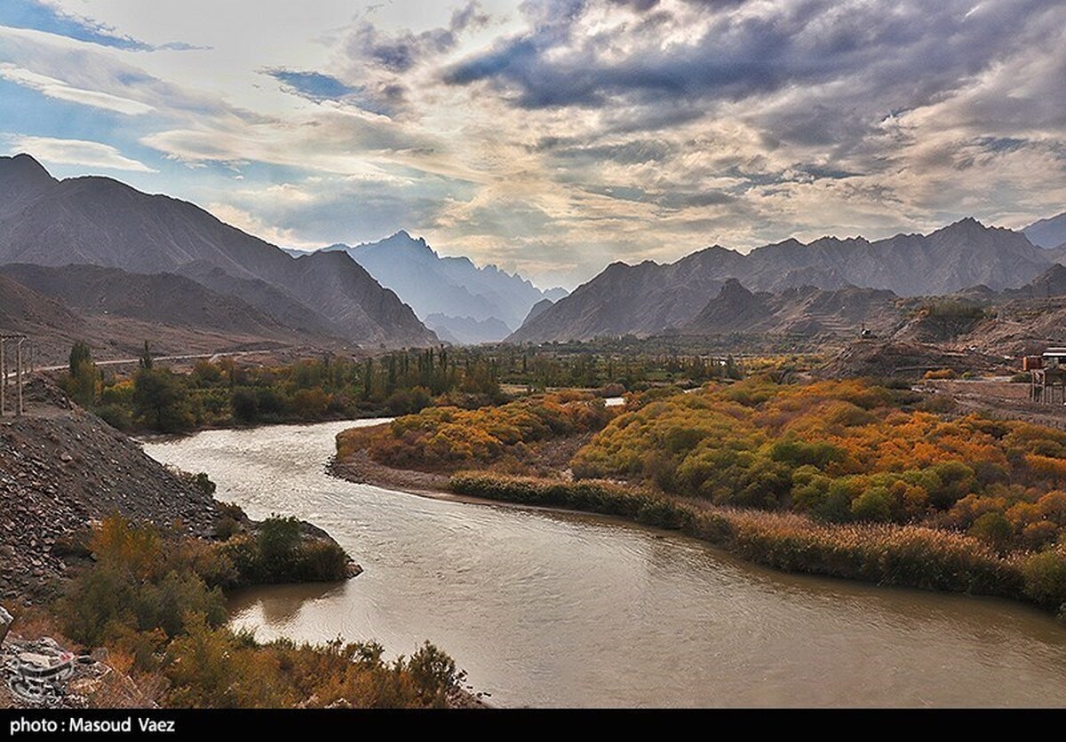
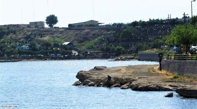
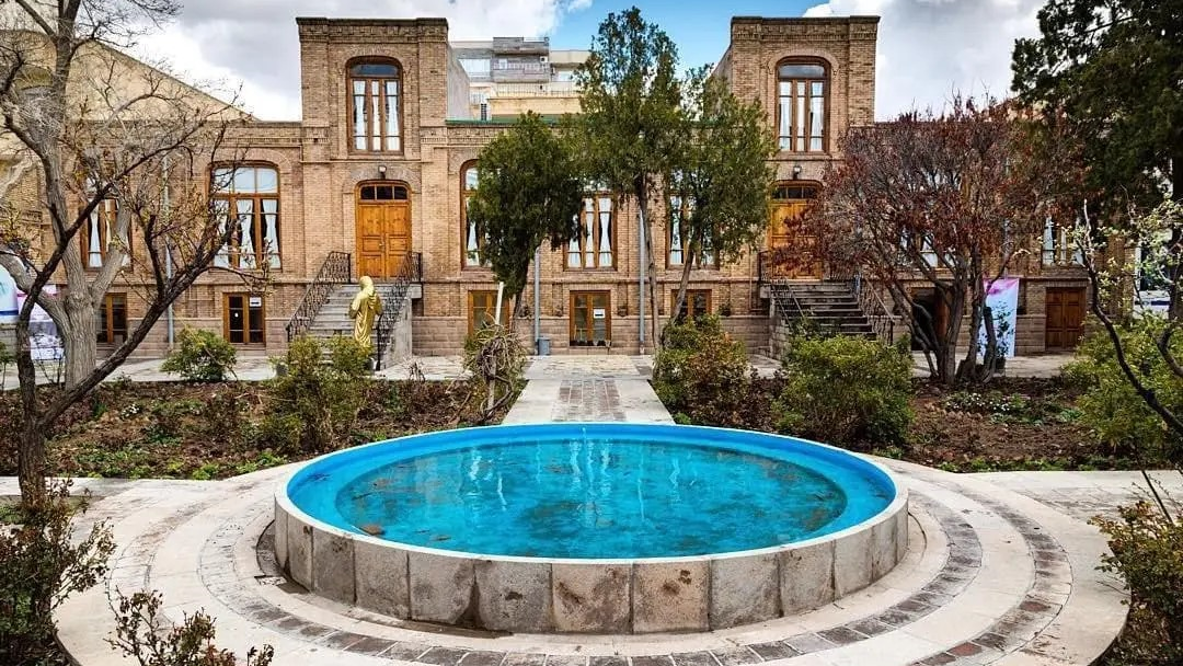
Aras River
Situated in the northernmost part of Iran, the raging Aras River is a beautiful and pristine landscape and is connected with many historical events.
Features of Aras River
Aras River is more than a thousand kilometers long and its average flow reaches more than 1200 cubic meters per second. This river originates from the Bingol Mountains in the Anatolian region of Türkiye and flows into the Kura River. The water of this river eventually flows into the Caspian Sea. After joining the Arpa River, the Aras River forms the common border of Iran with the Autonomous Republic of Nakhchivan, Armenia, and the Republic of Azerbaijan.
Aras River was recognized as the border of Iran and the Russian Empire from February 21, 1828, after the “Treaty of Turkmenchay”. Despite the passage of about 200 years since the separation of the two parts of the Aras River from each other, there are some rituals and customs that the people on both sides of this river share and establish cultural commonality between them.
Islands and Structures of Aras River
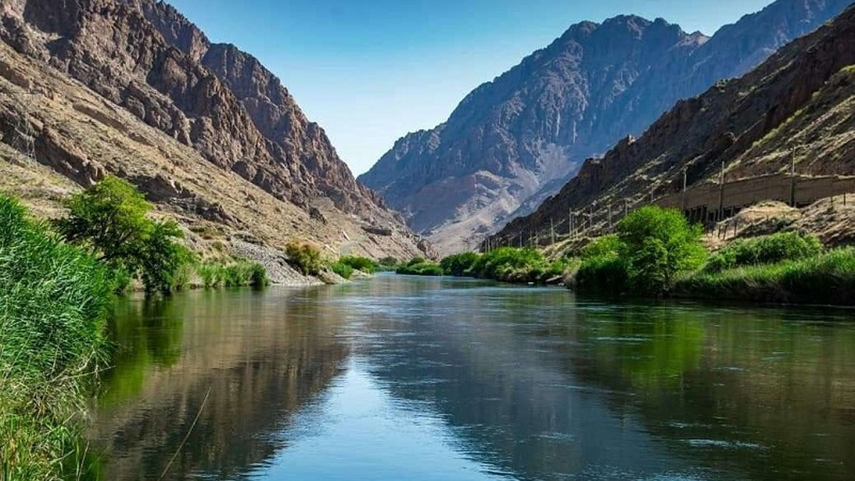
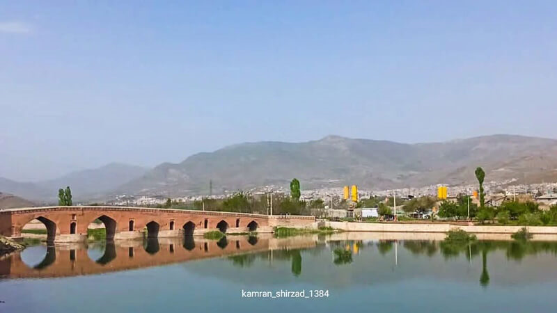
In order to connect the two sides of Aras River and use its water flow, some structures have been built on it in different periods of time. A dam named “Poldasht” which is located in an area with the same name, in the most northwestern region of Iran, is one of these structures that Iran and the Soviet Union built jointly. Khodaafrin and Qiz Qal’asi dams were also built on the Aras River jointly by Iran and the Republic of Azerbaijan. Also, five bridges named Ahani, Shuse, Poldasht, Khodaafrin (border of Iran and Azerbaijan), and Nordoz (border of Iran and Armenia) have been built on this river.
There are 805 small and big but uninhabited islands in the middle of the Aras River, which are called “Sham”. According to the border agreement, 427 of these islands belong to Iran and 382 islands to the Soviet Union, which are now part of the territory of the Republic of Azerbaijan.
Only a few of these islands have a name and the rest are just numbered. Usually, the main islands of this river are used to provide food for livestock.
The Name of Aras River and Its Place in Persian Literature
Aras River is called “Araas” in Turkish language, “Araaz” in Azerbaijani Turkish, and “Araaks” in Armenian. According to linguists, “Aras” is probably derived from the word “Araxs” in the Median, Medean, or Medic language, which means fast denoting the rapid flow of water in this river. Armenians believe that the name of the river is related to “Arast’, the great-grandson of the legendary Armenian family of Hayek.
Great Iranian poets such as Hafez, Rumi, and Nizami have mentioned the Aras River in their poems. In all of these references, Aras River is considered a roaring river overflowing with water. Also, in the opinion of Iranian poets, the Aras River is a place where it is possible to grasp the absolute truth and one can attain lofty spiritual levels by visiting it. As Hafez said:
ای صبا گر بگذری بر ساحل رود ارس/ بوسه زن بر خاک آن وادی و مشکین کن نفس
(O Wind if you pass by the shore of the Aras River/Kiss that land and purify your soul)
Aras in the Iranian Calendar
During World War II, the Soviet Union and England launched ground and air attacks on Iran on August 25, 1941. At the Jolfa border in the northwest of Iran, the Soviet forces planned to penetrate Iran by crossing over the iron bridge of the Aras River. Although the order was to retreat, three Iranian soldiers by the names “Musayeb Malek Mohammadi”, “Seyyed Mohammad Rathi Hashemi”, and “Abdullah Shahriari” voluntarily confronted the huge number of invading forces and kept them behind the border for 48 hours. The Soviet army was able to cross the bridge and enter Iran only after these three border guards were martyred.
In order to honor the resistance of these three soldiers against a well-equipped army and its formidable artillery August 25th has been named as the National Day of Aras in the Iranian Calendar.
| Name | Aras River |
| Country | Iran |
| State | East Azerbaijan |
| Type | Natural |
| Registration | No registration |


_crop_1_crop_1.jpg)
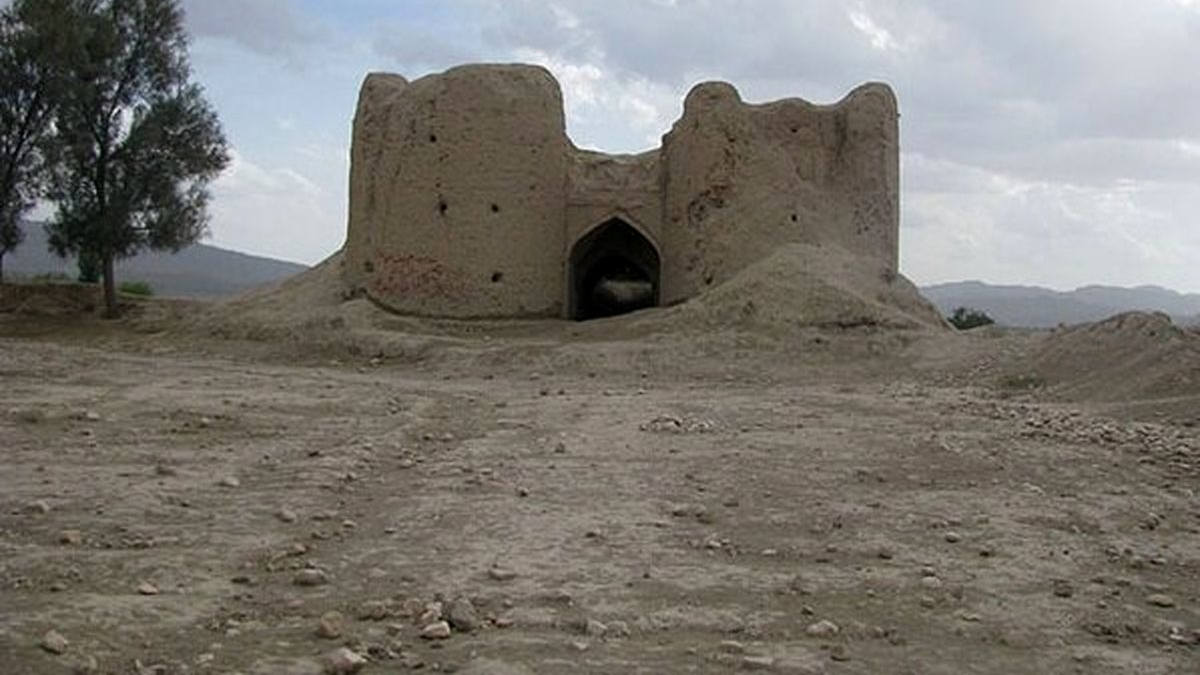
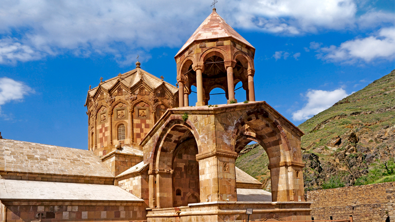
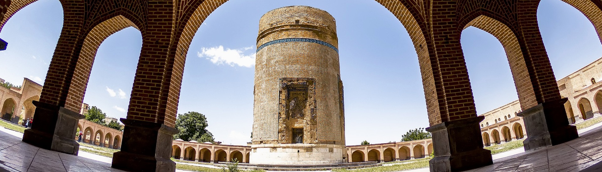
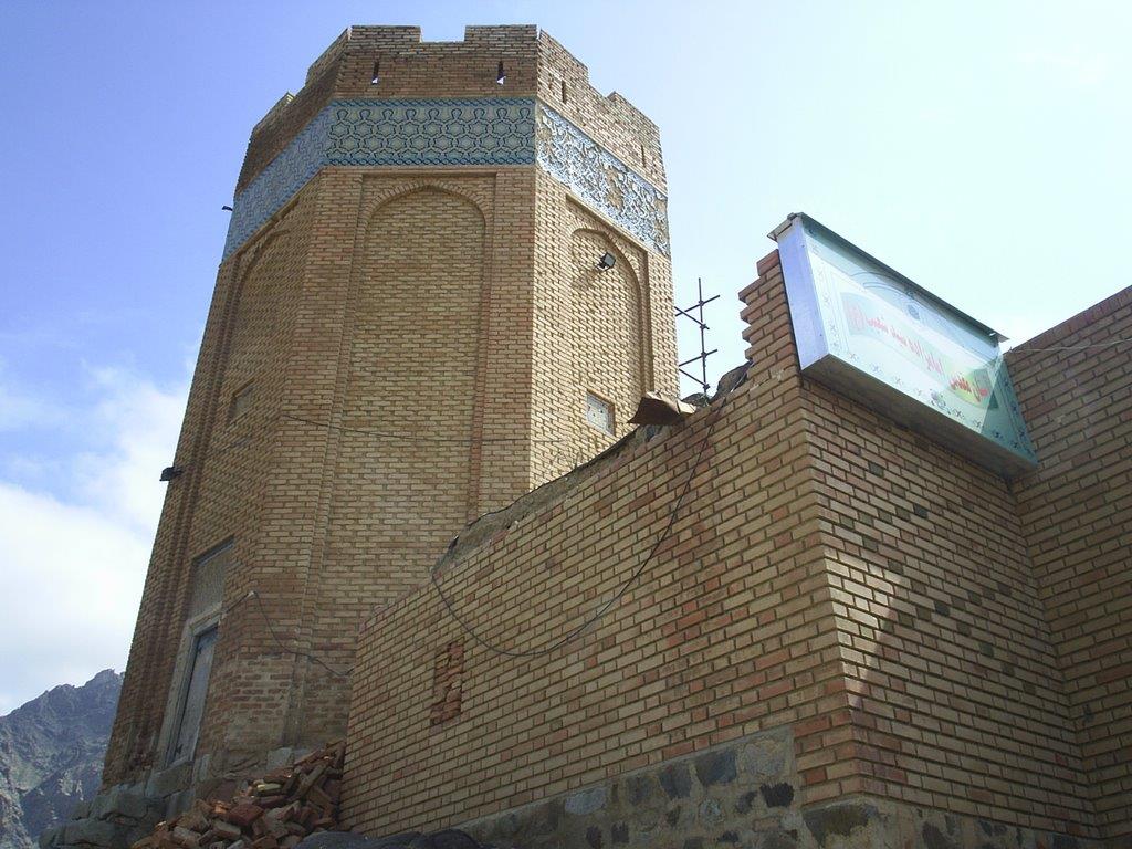
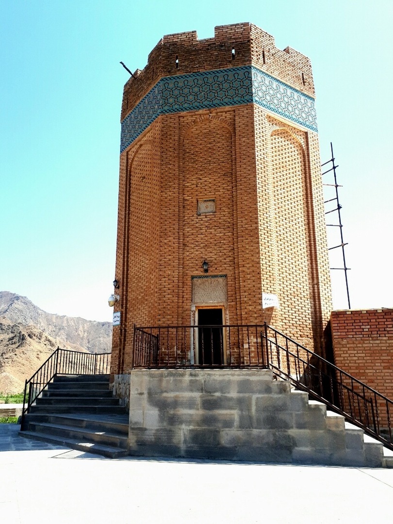
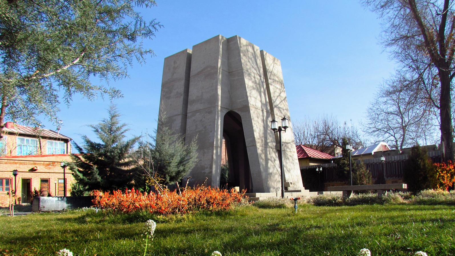
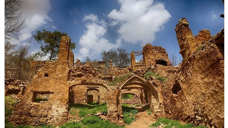
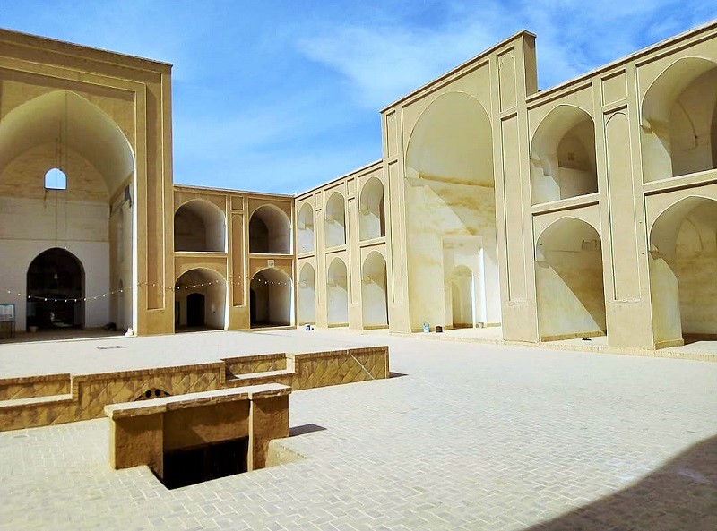
Dozal Tower: A Mausoleum atop a Peak on the Aras Riverbank
In the northern part of East Azerbaijan Province, along the southern banks of the Aras River, lie several beautiful villages. Some of these villages have gained fame for their breathtaking natural landscapes. However, among them are villages that, with their ancient structures, serve as ideal destinations for travelers interested in historical sites. The village of Dozal is one such destination — in addition to its abundant natural attractions, it boasts several historical landmarks, the most prominent of which is the Dozal Tower, located atop the tomb of Imamzadeh Shoaib.
History of the Dozal Tower
The village of Dozal is the burial site of several Imamzadehs (descendants of Shi’a Imams), but Imamzadeh Shoaib, whose tomb lies within the Dozal Tower, is the most renowned among them. He was the brother of Imam Reza and one of the sons of Imam Musa al-Kazim, the seventh Shi’a Imam. Historically, the death of Imamzadeh Shoaib is believed to date back to the Seljuk period (11th century AH / 17th century CE). However, the construction of the Dozal Tower is attributed to the Ilkhanid era (1256–1356 CE). During this time, the building of mausoleum-style monuments like this one was quite common. Similar structures can still be seen in Maragheh, which once served as the Ilkhanid capital. It is said that the tower originally contained a stone inscription providing genealogical details about Imamzadeh Shoaib and information about endowments (waqf) associated with him. Unfortunately, this inscription has been lost over time and is no longer accessible.
Features and Architecture of the Dozal Tower
The Dozal Tower has an octagonal plan and is built upon a stone base. This architectural style is common in many mausoleum structures in the region, especially those dating back to the Ilkhanid period. A similar tower, known as Momineh Khatun, is located in Nakhchivan. Both structures are alike in terms of construction techniques, choice of materials, and their elevated locations on hilltops. It is believed that both towers may have been designed by the same architect, highlighting the deep cultural connection between the communities on both sides of the Aras River.
The entrance of the structure is elevated about eight steps above the surrounding ground. Above the wooden entrance door, there are turquoise tile decorations, which have eroded over the years. The tower’s exterior is made of brick, and each of its faces features a pointed arch. A 110-centimeter band of azure tiles and exquisite mosaic work encircles the upper part of the tower, giving it an unparalleled grandeur. On the western side of the tower, there is a turquoise-tiled inscription displaying the name of the builder: “Master Mohammad ibn Jamal Ahmad.” The tower is situated on a hill overlooking the Dozal plain.
Overall, the tower consists of two parts: the crypt or base and the main body. From the floor of the crypt, the tower reaches a height of 11.9 meters. It appears that the tower once had a dome, which has collapsed over time due to erosion.
Where is the Dozal Tower located?
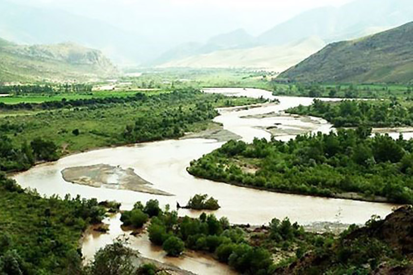
This tower is situated in a village called Dozal in Jolfa County, on the beautiful southern banks of the Aras River. Dozal village is part of the Siahroud district of Jolfa. About 500 people live in this village, making it one of the most populous villages in Jolfa. This population size is closely linked to Dozal’s strategic geographical location, as the village lies along key regional communication routes.
The short distance of this tower from the territory of Armenia is considered one of its interesting features. Opposite this village, across the Aras River, lies the village of Qarajavan (Qarchevan) in Armenia. Despite Dozal village’s geographical location, its climate is relatively warmer compared to the surrounding areas, making it possible to visit even in winter. It is said that “Bayender Beg,” one of the local rulers of the region, used to travel to this village during winter and return to his city after the weather warmed. The climate of Dozal has made it suitable for cultivating crops such as grains and legumes, as well as for sericulture (silk farming).
Dozal village is located near the historical village of Kordasht. During the Iran-Russia wars in the early 19th century, Kordasht served as a gathering place for Iranian army forces. This beautiful village also hosts notable historical structures, making it, along with Dozal, a key tourist hub in the region.
National Registration of Dozal TowerThe tomb of Imamzadeh Shoaib and Dozal Tower were registered on Iran’s National Heritage List in 1983 (1362 SH).
| Name | Dozal Tower: A Mausoleum atop a Peak on the Aras Riverbank |
| Country | Iran |
| State | East Azerbaijan |
| City | Jolfa |
| Type | Historical |
_crop_2.jpg)


Choose blindless
Red blindless Green blindless Blue blindless Red hard to see Green hard to see Blue hard to see Monochrome Special MonochromeFont size change:
Change word spacing:
Change line height:
Change mouse type: