Water Distribution System in Semnan
Despite the fact that Semnan is located in a desert region, it should be considered a “garden city” in terms of urban planning. This feature has caused this city to be nicknamed “the jewel of the desert” since ancient times. Of course, due to such issues as shortage of water and the expansion of the urban fabric, many green orchards of this city have disappeared, but signs of traditional orchards and their precise irrigation system can still be observed in the southern part of Semnan; the orchards that have been, since ancient times, attracting every traveler upon entering the city. In the past, the orchards of Semnan surrounded the urban space and every traveler who came to this city had to pass through pleasant-looking and green orchards after entering the city gate to reach the urban space. Thus, someone who had traveled a long path in the dry and burning desert would feel relaxed after seeing such refreshing and beautiful orchards!
The Origin of Semnan Orchards
Experts believe that the formation of the urban body of Semnan is related to the precise water distribution system that someone by the name of “Sheikh Ala’ al-Daulah Semnani” had created during the Ilkhanate era. He was born in 659 AH (1261 AD) and died in 736 AH (1336 AD). There is a tomb attributed to him in Sufi Abad Village of Sorkheh City of Semnan Province, which is regularly visited by the people of this city. During the 77 years of his life, he wrote books on astronomy, engineering, mysticism, and Sufism, of which 39 volumes are available today. Although some experts believe that the life of the Semnan irrigation system is more than a thousand years, Sheikh Ala’ al-Daulah is remembered as someone who transformed Semnan by developing and expanding this system.
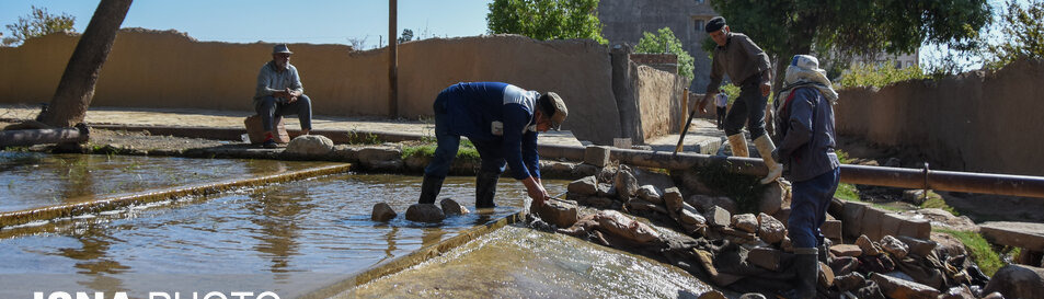
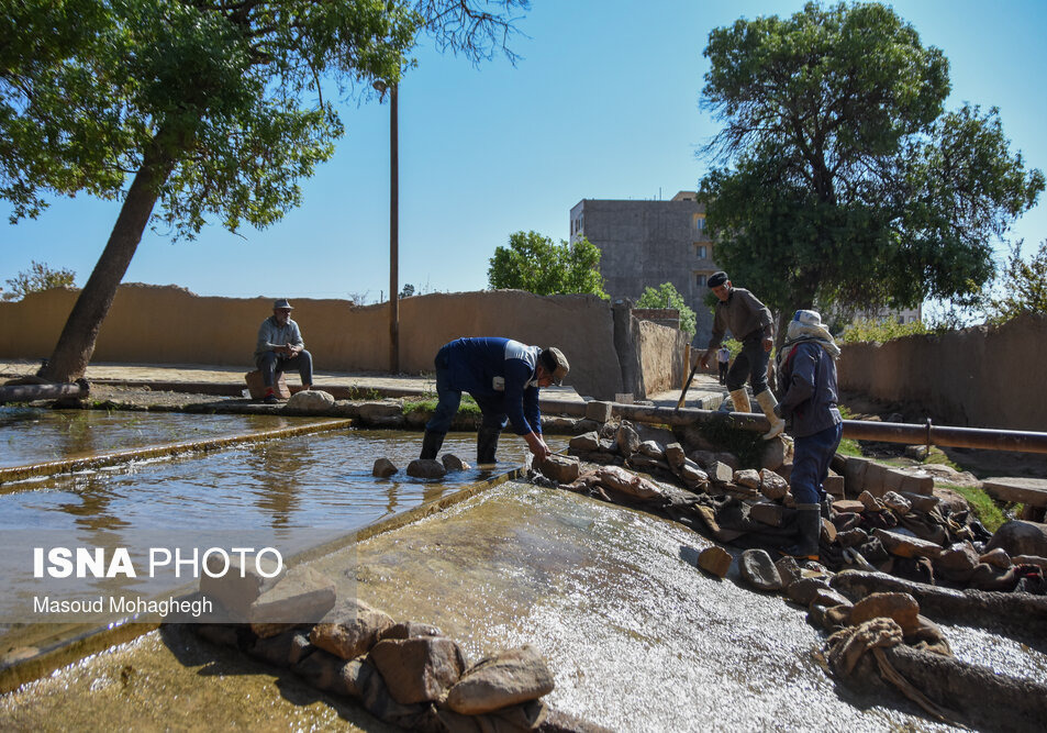
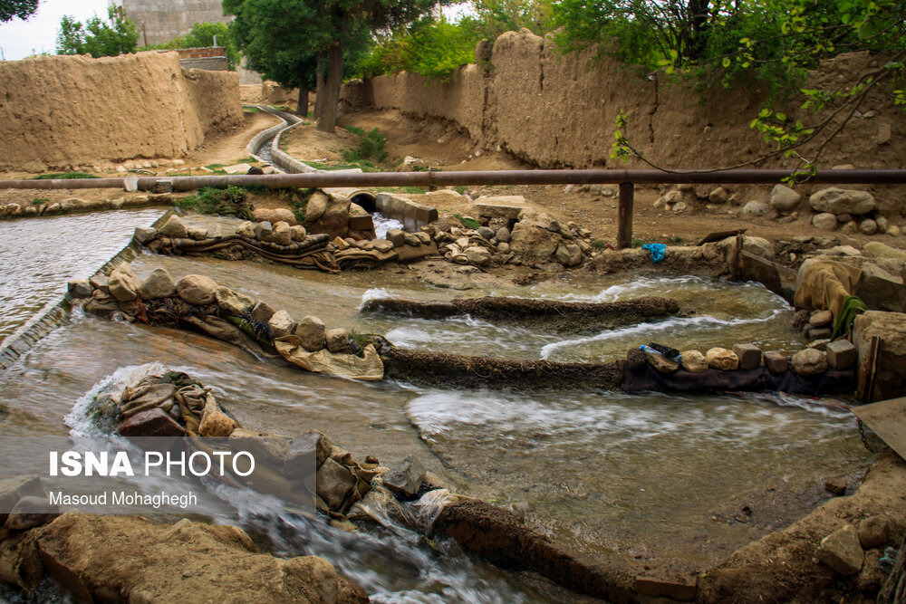
Sheikh Ala’ al-Daulah’s innovative system sought to preserve water resources by using structures called “Estaleh” (pools) and small streams. In the Sheikh Ala’ al-Daulah plan, the water of the “Golrudbar” River, which enters the city from the north, is divided into five parts in a place called “Abpakhsh” (water distribution point) and flows into six pools (Zavaghan, Kushamghan, Kadivar, Latibar, Nasar, and Shahjoy). Among them, five pools are still active and were inscribed on the list of Iran’s national heritage, along with the “Negahban-e Aab” (Water Guard) or “Pa” building, in the year 2003 AD. Letibar is considered the only pool of this collection, which was destroyed due to the implementation of urban development operations, and its water was transferred to another place, which today is called “Stone Park”. The water from the pools flows in streams and is finally used in the orchards in the south of Semnan and then in the agricultural fields. In the old irrigation system, excess water was used for irrigating the agricultural fields near Sorkheh City, and after reaching Sorkheh it was directed to a series of qanats, each of which went to a village to irrigate the fields there. In this design, the topography and the slope of the land were carefully studied and everything was organized in such a way that the least amount of water was wasted.
One of the important effects of the water distribution system in Semnan was the creation of numerous garden alleys, each of which has a special name among the local people on the basis of its characteristics. For example, “Ney Kijeh” is an alley where many reeds grow, and “Anjila” is an alley with many fig trees. Espi Paul, Kandaneh, and Mian Mahalleh are other famous alleys in Semnan.
This system was formed in a city like Semnan, which was considered a desert city and the value of water was manifold, by keeping in view the importance of water resources and the need to obtain maximum productivity by using it. In the past, the distribution of water was done by someone who was the guardian of the water and was called “Barjomdar”. Based on a drafted schedule, Barjomdar directed the water to specific paths for the orchard keepers to use. Even today, each of the orchards in the south of Semnan has a share of water. In the southern part of the city of Semnan, after the orchards, agricultural lands are located, which continue up to a road called Silo, and then the desert area begins. In this way, a variety of climates can be seen in a very small area, which is one of the most beautiful effects of the ancient water distribution system in Semnan.
The water distribution system of Semnan was inscribed on the list of Iran’s intangible national heritage in the year 2011 AD.
| Name | Water Distribution System in Semnan |
| Country | Iran |


.jpg)
.png)

.jpg)


Choose blindless
Red blindless Green blindless Blue blindless Red hard to see Green hard to see Blue hard to see Monochrome Special MonochromeFont size change:
Change word spacing:
Change line height:
Change mouse type: