Lost Paradise of Marvdasht
The name “Lost Paradise” may remind you of John Milton, an English poet and writer who wrote many articles about freedom during the 66 years of his life, and his most important work was the novel “Paradise Lost”. But the lost paradise that we will introduce here is not a story and is completely true; although it is so beautiful that the description of its beauty may sound like a fantasy!
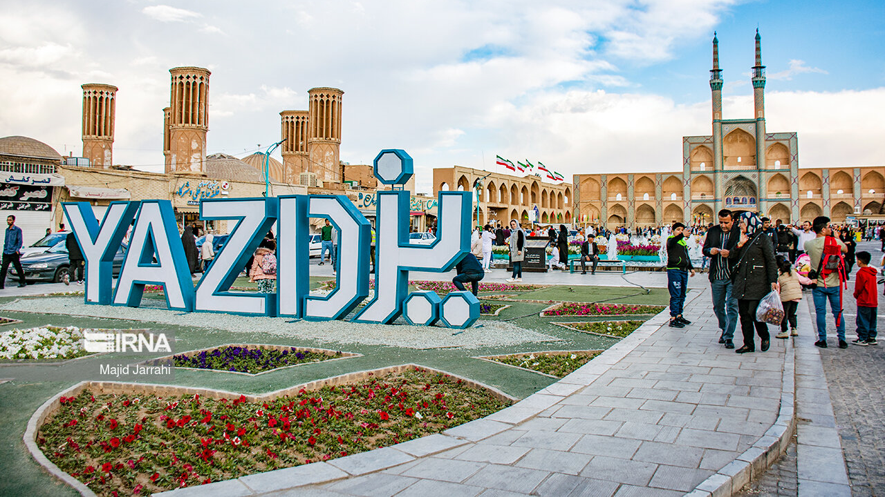
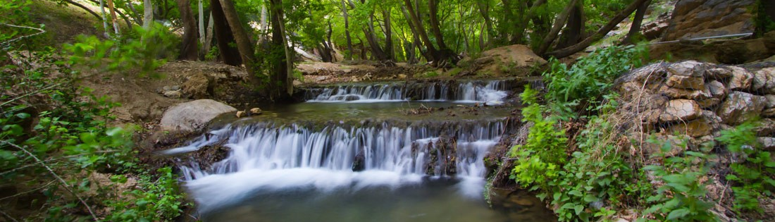
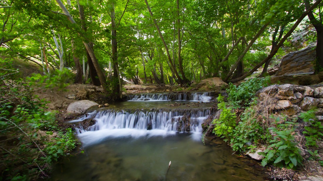
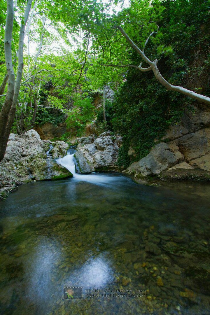
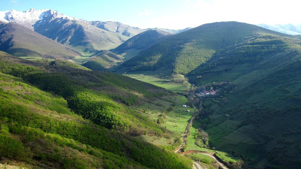
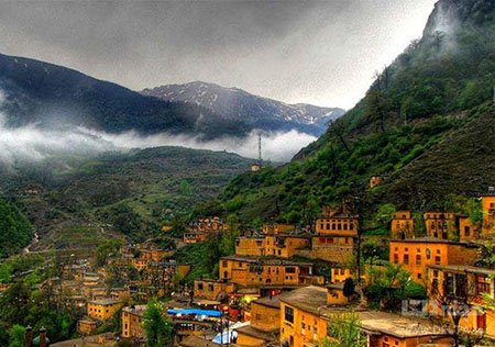
“Lost Paradise” is a name given to a very beautiful area in Iran; an area in the Kamfirouz district of Marvdasht city in Fars province. The original name of this area was “Tang-e Bostanak”, but today, it is popularly known as “Lost Paradise”.
One of the most important advantages of “Lost Paradise” is its short distance from the historical attractions of Fars province, such as Pasargad and Persepolis. This short distance has made the tourists who visit ancient places include the visit of Tang-e Bostanak and the beautiful nature of this area in their travel plans.
Geography and Features of “Lost Paradise”
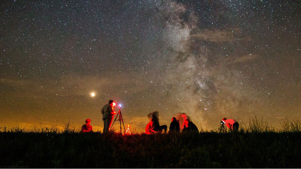
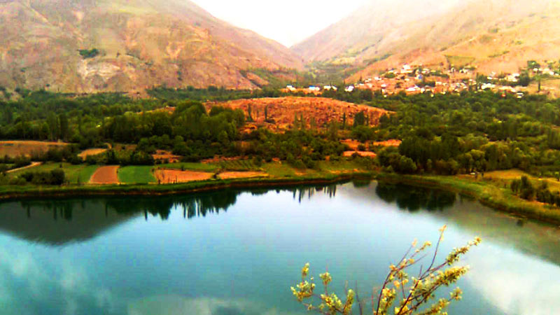
“Lost Paradise” is one of the protected areas of Iran, which is located in the northwest of Shiraz. The vegetation of Tang-e Bostanak is very dense and numerous waterfalls and streams have doubled the beauty of its landscapes. Due to the tangled foliage, sunlight does not shine through them in some parts of the forest, making it very dark; like night! “Lost Paradise” is one of the most suitable areas around Shiraz for nature tourism and mountaineering.
Before the 1980s, very few people and tourists knew about the existence of this beautiful area. However, its beauty began to gradually draw more attention to nature tourists who gave it the nickname “Lost Paradise”.
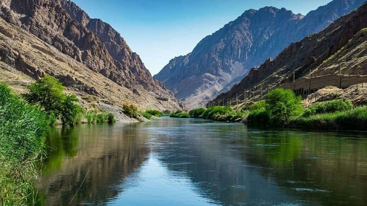
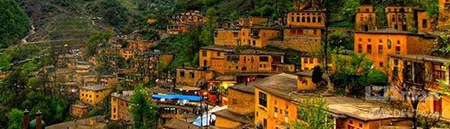
Tang-e Bostanak is located in the catchment area of the Kor River and Doroudzan Dam and within the vicinity of Margoon Waterfall and several villages. Kor River is the largest river in Fars province, which is 280 km long and passes through attractive areas such as Tang-e Boraq, Doroudzan Dam, Darasht of Ramjerd, and Tang-e Bostanak. Mangan, Mahjanabad, Dashtak, and Jidarzar are some of the villages of this region.
Flora and Fauna of “Lost Paradise”
The tight climate of Bostanak has provided suitable conditions for the growth of almond, barberry, oak, and walnut trees. All kinds of plants such as Alhagi, Mugworts, Liquorice, and Milkvetch, which have therapeutic properties and are used in Persian traditional medicine grow in this area. The bottom of Tang-e Bostanak is covered with stone and rock, and trees such as planes, walnut, etc.
Tang-e Bostanak is also the house to many animals, including birds of prey, brown bears, otters, squirrels, foxes, sheep, rams, wild goats, and rabbits.
How and When to Get to “Lost Paradise”
Kamfirouz City is located near the Dena mountain range and is considered the most important resort area around Shiraz. “Lost Paradise” is located in this city with an area of 20 thousand hectares, 120 km from Shiraz. The height of this area is between 1700 and 3700 meters above sea level.
Dashtak village in Kamfirouz City is the closest village to this area. Nature tours usually start their journey from this village. It is possible to reach this village through Marvdasht-Beyza road. If you plan to travel to “Lost Paradise” from Shiraz, you should take the road to Beyza village in the northwest of Shiraz and go to Haftkhan village after passing the Beyza and Posht Bagh villages. Then go to Kamfirouz and after passing this city, move towards Tang-e Bostanak, which is located just before the Mehenjan village.
The best times to travel to the “Lost Paradise” of Iran are the months of April and October.
“Lost Paradise” is a name given to a very beautiful area in Iran; an area in the Kamfirouz district of Marvdasht city in Fars province.
| Name | Lost Paradise of Marvdasht |
| Country | Iran |
| State | Fars |
| City | Marvdasht |
| Type | Natural |
| Registration | No registration |
.jpeg)

-k- main.jpg)
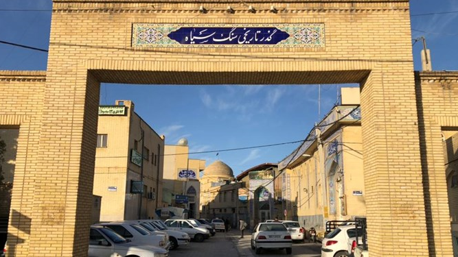
Marvdasht
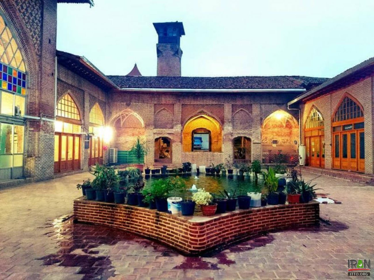
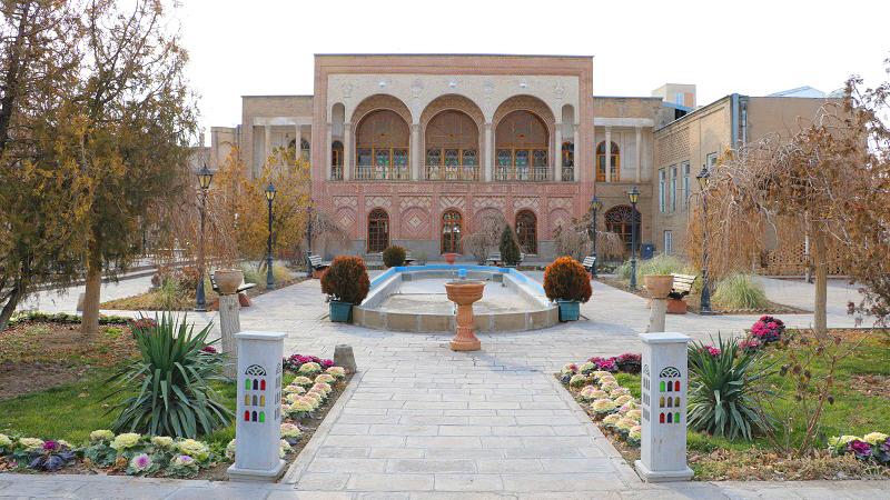
Located over an area of 4649 square kilometers, Marvdasht County of Iran’s Fars province houses a valuable collection of ancient monuments including the historical Persepolis. The county has a population of more than 300 thousand people and being situated in a mountainous area, its climate is moderate in summers and cold in winters.
Marvdasht City is located 40 kilometers north of Shiraz, and with a population of more than 150,000 people, it is the second most populous city in Fars province. The height of this city is 1620 meters above sea level and has a moderate to cold climate.
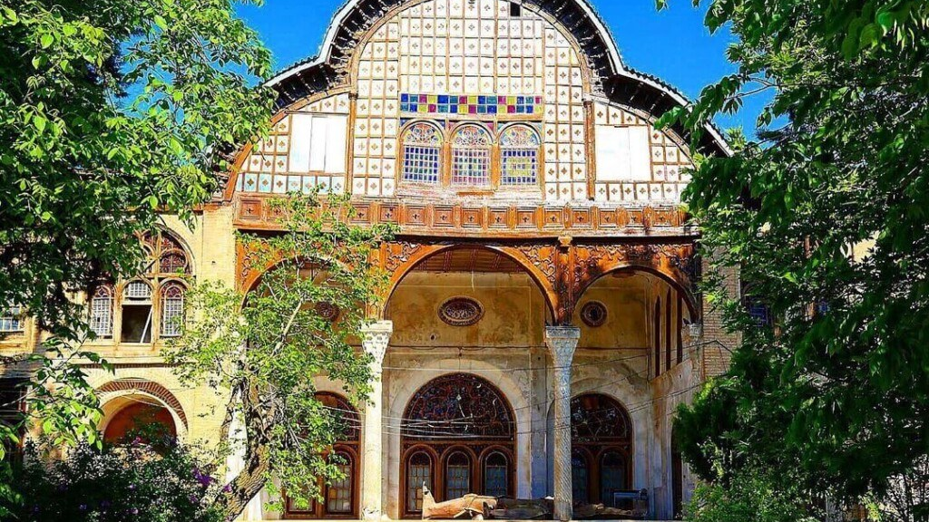
According to historians, the history of this city goes back to the 5th millennium BC and was the habitat of some prehistoric humans. However, the core of today’s Morvdasht was in 1933 AD with the establishment of the sugar factory migration of many working families to it. Being a historical city, Marvdasht houses more than 150 precious historical works.
Natural Attractions of Marvdasht
The northern region of Marvdasht is mountainous and its southern regions are flat and suitable for agriculture. There are some high mountains such as Siah (3400 meters), Saroun (3750 meters), and Palangari (4145 meters). The rivers of this area include the Sivand and Kor Rivers, and its other tourist attractions are Doroudzan Dam, Lost Paradise, Chahou Gorge, and Hossein Mountain.
Lost Paradise
Tang-e Bostanak, which is also called “Lost Paradise”, is one of the most attractive and pristine natural attractions of Fars province, which is located in the Kamfirouz region of Marvdasht city. This protected area is famous for its dense vegetation and is the catchment area of the Kor River and Doroudzan Dam.
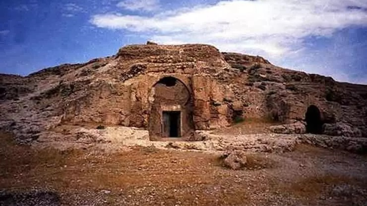
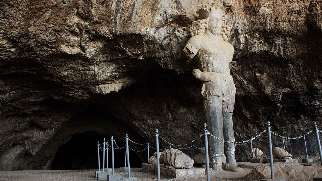
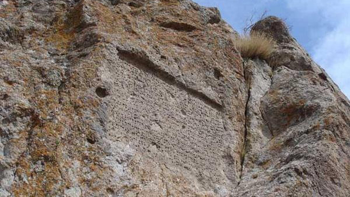
Palangan Cave
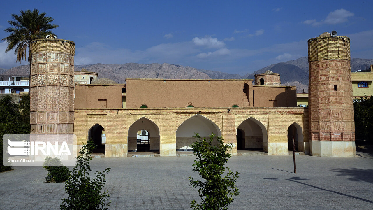
Located 75 km north of Shiraz, Palangan (meaning leopards) Cave is one of the natural attractions of Marvdasht. The cave was given this name because the footprints of leopards were found in it. This cave is more than 30 meters long and the bones of wild animals can be seen everywhere.
Tangeh Bolaghi
This gorge is an 18 km long valley located in the south of the Pasargad ancient complex. The passage of the permanent Sivand River through this gorge, whose width varies from 500 to 10 thousand kilometers, has made its landscape very beautiful. One of the reasons that many civilizations had emerged around this valley is the presence of rich water resources. So far, nearly 140 ancient monuments from the prehistoric period to the Islamic era have been identified in this area.
Tang-e Khoshk
There are several waterfalls some 30 km northeast of Marvdasht, in front of Sivand village, that flow during the rainy season. This gorge is nearly 20 kilometers long and about two kilometers wide and has such vegetation as Pistacia atlantica, Prunus scoparia, Almond, and Acer monspessulanum trees. This had a mine in the Achaemenid from which building stones were extracted.
Badreh Garden
There is a beautiful promenade in the picturesque village of Abanar, which is called Bagh-e Badreh. The large pond in the middle of this garden gets filled with water from the surrounding springs. The dense maple trees have made this garden look very pleasant.
Shadab Cave
This amazing and mysterious cave, which is also known as “Bride’s Cave” and is one of the national monuments of Iran, is located 30 kilometers northwest of Marvdasht. It takes about two hours of climbing to reach this cave, which is why it has so far remained pristine and untouched.
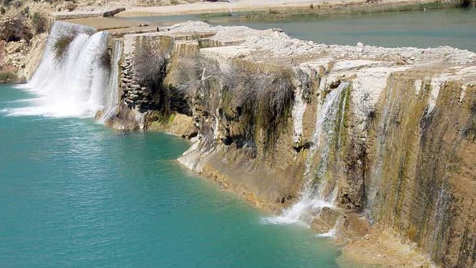
Doroudzan Region
This region is considered one of the main destinations for nature tourists. The main attraction of this region is the Doroudzan Dam, which is built 50 kilometers northwest of Marvdasht on the Kor River. This dam was completed in 1972 and its water is used for supplying drinking water to nearby cities. There are two high waterfalls some eight kilometers south of Doroudzzn Dam, near a village called Dashtak, which are quite attractive.
Another tourist attraction of the Doroudzan region is “Tirbagh”, which is located near a village called Kondazi with beautiful vegetation and many springs making it a pleasant destination for tourists.
According to historians, the history of Marvdasht goes back to the 5th millennium BC and was the habitat of some prehistoric humans.
| Name | Marvdasht |
| Country | Iran |
| State | Fars |
| City | Marvdasht |


Less-Known Tourist Attractions of Marvdasht
Situated in the north of Fars province and 40 km from Shiraz, the ancient city of Marvdasht is mostly known for its prehistoric sites such as Persepolis. However, there are many other tourist attractions and historical sites in this city that have been shadowed by more well-known sites and have been less noticed by tourists.
Known Historical attractions of Marvdasht
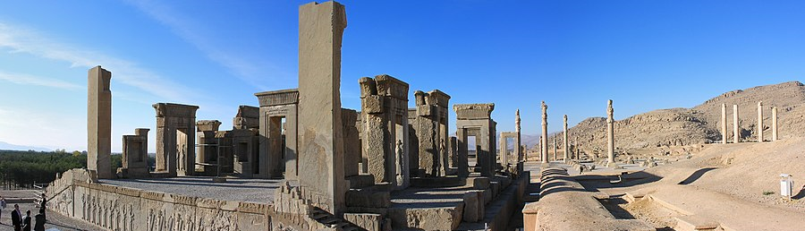
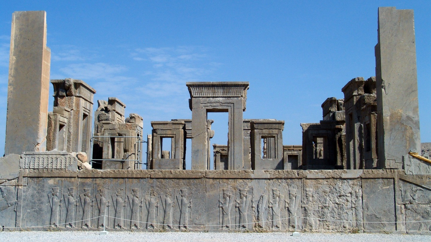
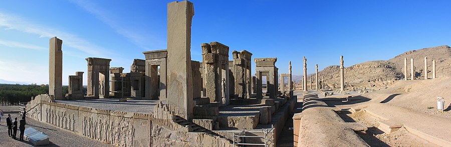
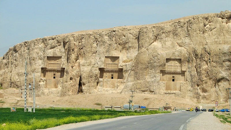
Perhaps, Persepolis can be considered the most well-known historical site of Marvdasht. This ancient palace consisted of an amazing collection of architectural works of the Achaemenid era (550 to 330 BC). Naqsh Rostam is another ancient complex of Marvdasht, which has been of interest from around 1200 BC to 625 AD and has preserved works from 18 centuries of Iranian history.
Pasargad is another historical complex in Marvdasht, where the tomb of Cyrus the Great (reigned from 559 to 529 BC), which is one of the most famous sites of the area is located. There are also several other palaces and structures in this complex that are less known.
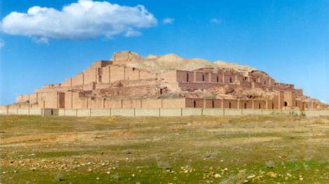
Naqsh-e Rajab should also be considered one of the most famous historical sites of Marvdasht. This historical site contains some fascinating petroglyphs pertaining to the Sassanid era (224 to 651 AD). Mention should also be made of the ruins of Istakhr City - situated some seven kilometers north of Persepolis, which, according to historians, was the largest city of that era.
The Less-known Attractions of Marvdasht
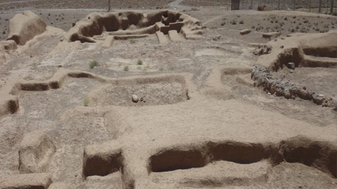
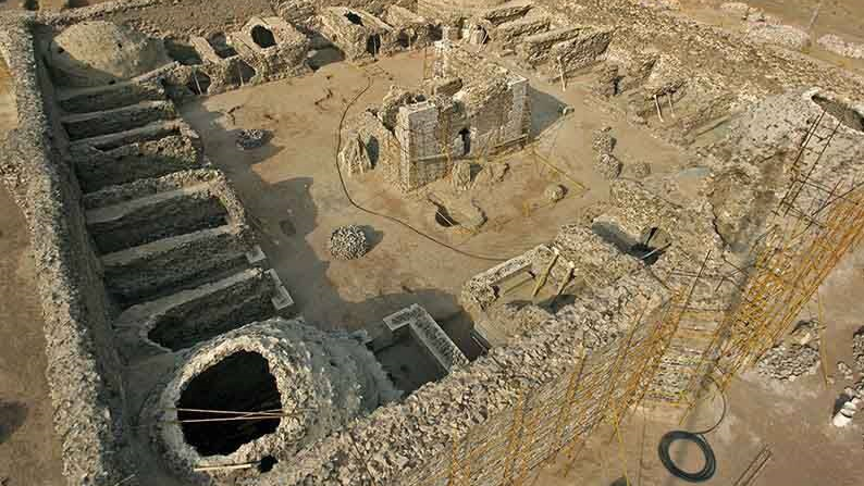
Tall-e Bakun
This historical site was a human settlement between 4000 and 3500 BC. Pottery works with beautiful motifs and the broken cross, belonging to Aryan religions, are the most important discoveries from this region.
Tall-e Shagha
Another ancient site of Marvdasht, where several archaeological excavations have been carried out, is called “Tall-e Shagha”. This area is located in the west of Khairabad Village and was inscribed on the list of Iran’s national heritage in 1976.
Tall-e Nokhodi
One of the less-known attractions of Morvdasht, this site dates back to the prehistoric era and valuable artifacts have been discovered in it.
Qarah Qalat
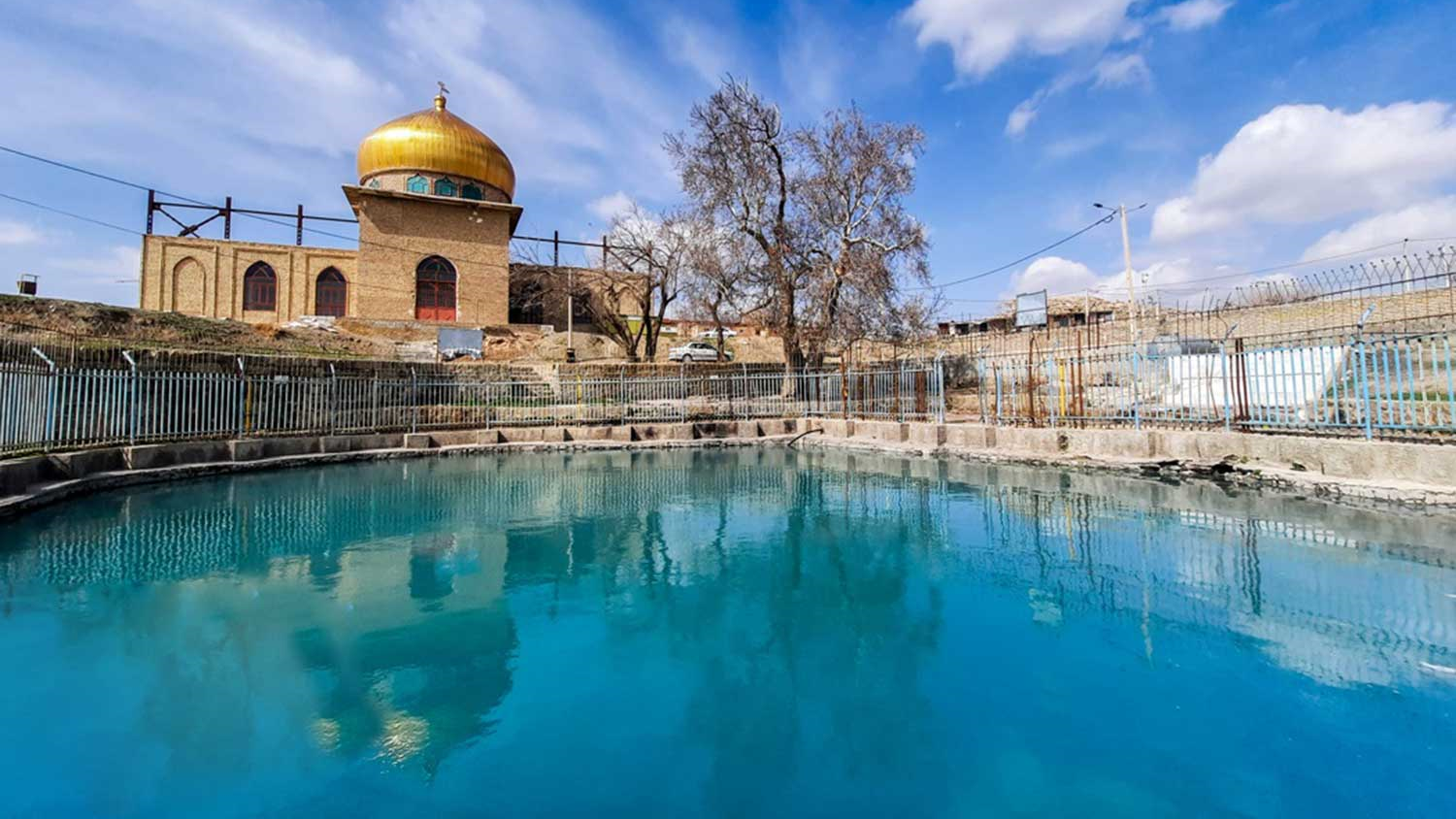
Also known as “Qalat Palace”, this monument has been left from the Achaemenid period. Most likely, this palace was used as a resort. There is a pool in the middle of this palace, whose water is supplied by springs that boil from the heart of the nearby mountains.
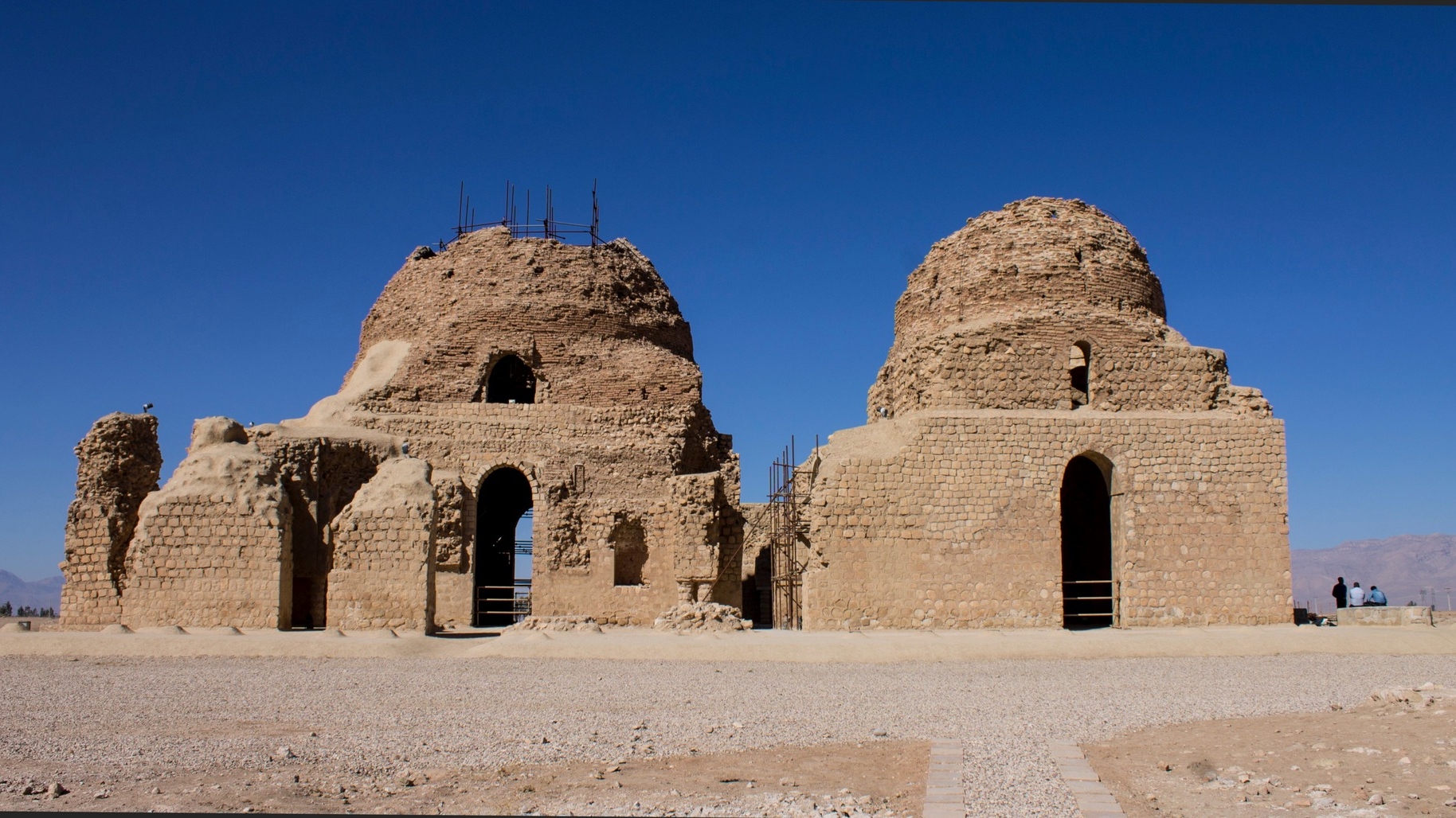
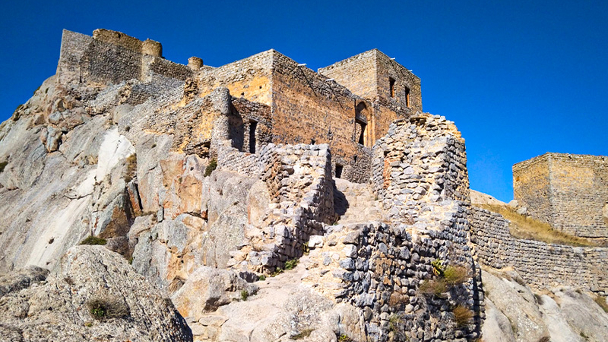
Broken Castle
The remains of a castle, commonly known as the “Broken Castle” can be seen on top of three hills, which are called the “three domes” by the locals. The history of this castle, which is located in the east of the Estakhar region and in an area called Ramjard, dates back to the time of the advent of Islam in Iran (651 AD).
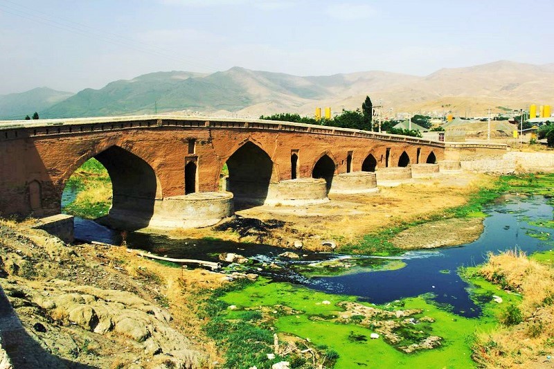
Sivand Bridge
This bridge, which is located on the Palvar River in the Sidan region of Khafrak Alia district of Sivand Village is left from the Sassanid era. The numerous openings of this bridge have given it a unique effect. The foundations of the southern part of the bridge have been made in a triangular shape on one side and in a circular shape on the other side, which is quite unique and interesting, in order to break the pressure of water flowing through it.
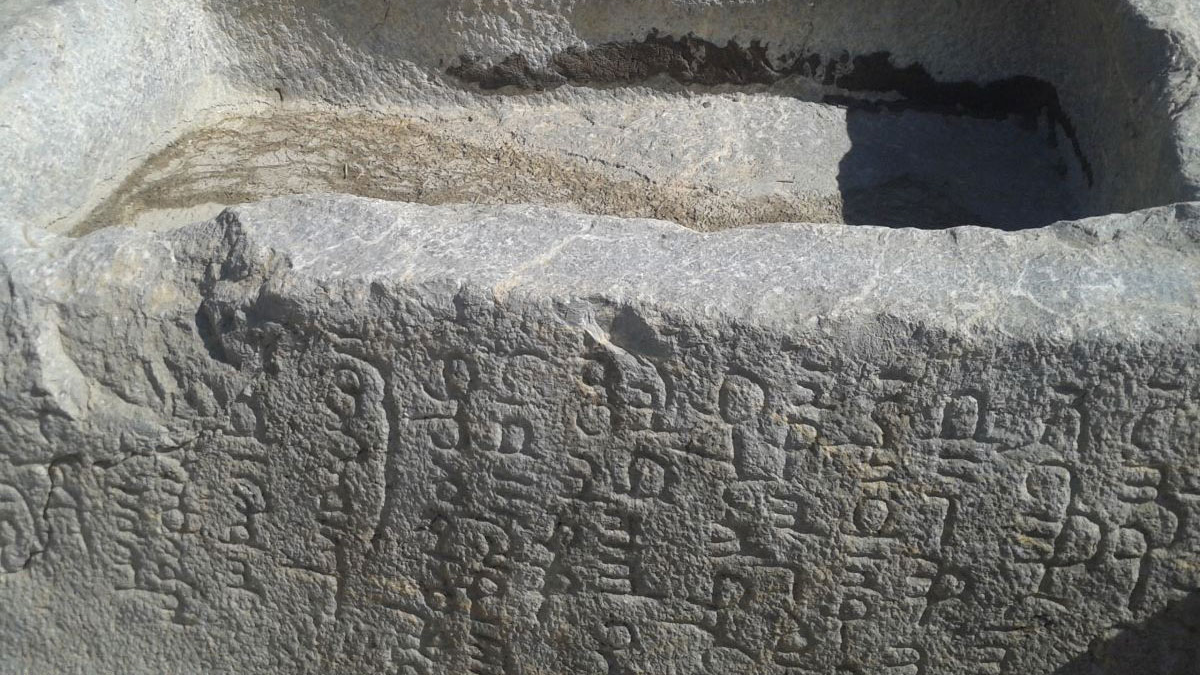
Pahlavi Inscription of Bani Yekkeh
Many stone inscriptions were created during the Sasanian era to record events. One of these stone inscriptions is located in the village of Bani Yekkeh in the northeast of Estakhar mountain. This work, written in the Pahlavi language, was inscribed on the list of Iran’s national heritage in 2008.
Estakhar Bridge
This bridge is also left from the Sassanid period and is located in the village of Hajiabad, in the southwest of the city of Estakhar. The remains of this bridge show that it was a large structure and made transportation over the river possible.
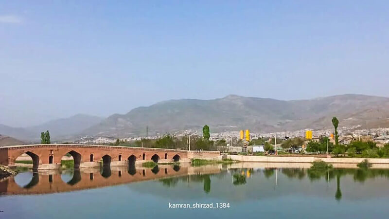
Band-e Amir Bridge
This bridge was built on the Ker River during the time of the Daylamite king, Adud al-Dawla (949 to 983 AD). The foundations of the bridge are made of limestone, brick, and mortar. The stones of the bridge are connected using iron fasteners. According to experts, this bridge was built on a foundation that was left from the Sassanid era.
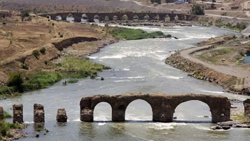
Khan’s Bridge
Khan’s Bridge, which was built about 500 years ago on the Kor River, is another less-known historical attraction of Marvdasht. This bridge was built by a person named “Imam Qoli Khan”. The bridge is 101 meters long, five meters wide, and 13 meters high. There are five openings in the bridge for the passage of water.
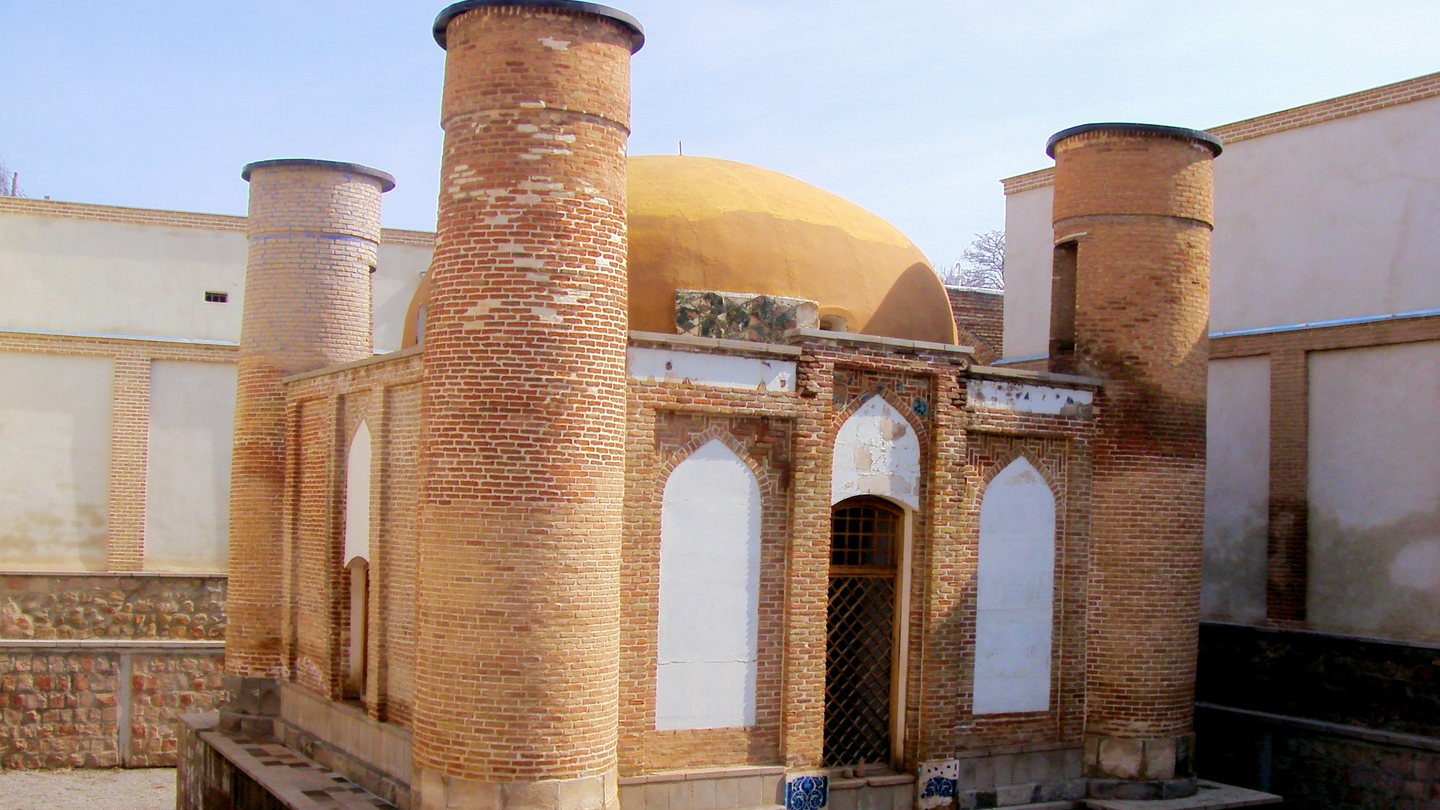
Tomb of Ayub-e Nabi (Prophet Job)
There is a tomb in the vicinity of “Chamani” Village in Ramjerd district of Marvdasht, which according to local people is the burial place of Prophet Job and his wife, Bibi Rahima. Because of the existence of this tomb, the mountain where this tomb is located is called Mount Ayub-e Nabi. The tomb building is located at an altitude of 1650 meters above sea level. There are also 9 tombstones related to the Safavid era the date written on one of which is 1047 AH (1637 AD).
| Name | Less-Known Tourist Attractions of Marvdasht |
| Country | Iran |
| State | Fars |
| City | Marvdasht |
| Type | Historical |
| Registration | National |


.jpg)
 در تخت جمشید_crop_2.jpg)
Choose blindless
Red blindless Green blindless Blue blindless Red hard to see Green hard to see Blue hard to see Monochrome Special MonochromeFont size change:
Change word spacing:
Change line height:
Change mouse type: